
Back in May, we released a collection of mapped illustrations from the 1878 Combination Atlas Map of Clinton County, Indiana by Kingman Brothers of Chicago. Up to now, the full text has not been freely available in digital form--you could only access a microfilmed version by paying for an Ancestry.com subscription. But with with Archive.org, … Continue reading 1878 Atlas Full Text Available
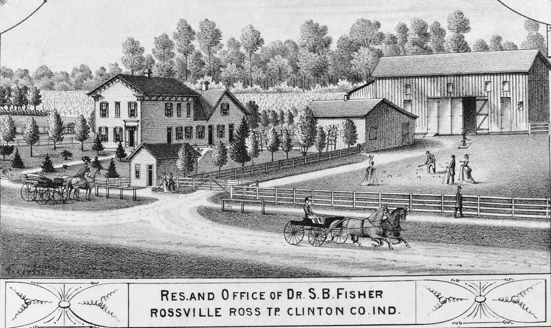
1878 Homestead Illustrations Mapped
I am very excited to release a project I have been working on for months: the digitization and mapping of 118 illustrations of Clinton County homes and businesses from the 1878 atlas of Clinton County. If you have never seen this atlas, the illustrations are amazingly detailed and accurately portray many farms and towns as … Continue reading 1878 Homestead Illustrations Mapped
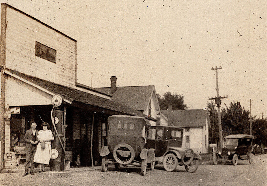
Town Histories: Cambria
Cambria in 2009 This is part of our planned series of Town Histories where we will gather information and resources on every town in the county. We welcome submissions of information, stories, or photographs to be included on this and other towns. This page, like the project in general, is a work in progress. Location … Continue reading Town Histories: Cambria
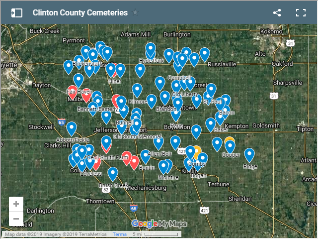
All Known Cemeteries
Below you will find an interactive map and list of all known cemeteries in Clinton County, along with their periods of activity. Click any cemetery on the map to see more information about it, or click the rectangle icon at the upper-right of the map to make it full screen, where you can search by … Continue reading All Known Cemeteries
Atlas Details Through The Years
It is interesting to look at old state atlases and see what towns were deemed important enough to include in the small area dedicated to Clinton County. Here is a selection of these spanning over almost a century.
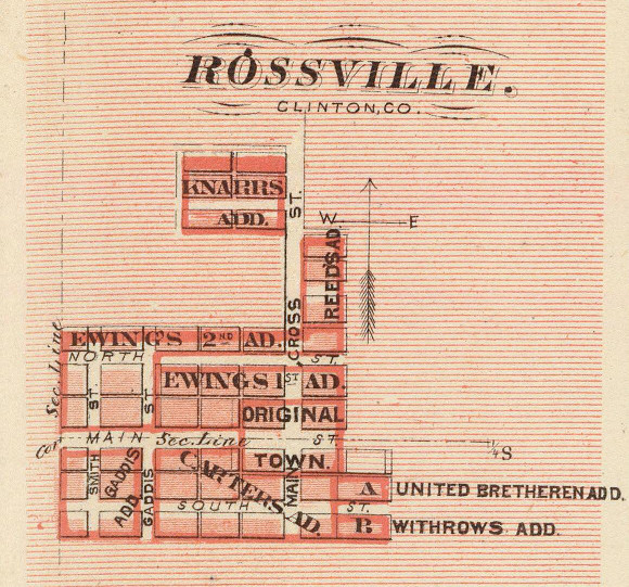
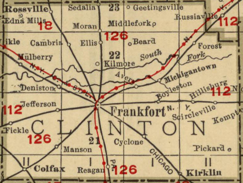
Town Maps
These town maps are taken from various atlases, larger maps, etc. Some no longer exist, but all are from Clinton County. They are in alphabetical-chronological order. Click any image to flip through them as a slideshow. Note that though not included here, you can find detailed Sanborn fire insurance maps of Colfax and Frankfort in … Continue reading Town Maps