This is a summary of books, atlases, and other resources pertaining to Clinton County which are available online. For a fuller listing of books and maps, including those only available in print, see the Indiana State Library’s guides to County Histories and Maps. To jump to the relevant sections, click the quick links to the right.
Indexes
Master Index of Clinton County Histories and Atlases
This is a searchable index which covers all the major county histories and the historical atlases that include biographies. Note that these indexes only cover the names of the subjects of biographies and those photographed–not the many other names mentioned within the biographies themselves. For that, you have to use the WPA/Indiana State Library index listed below.
Clinton County, Indiana Index of Names of Persons and Firms
This is an enormous index from the WPA/Indiana State Library covering most of the material listed below, but sadly the text is too blurry for the optical character recognition to work well, so you can’t use the search function and get reliable results–you have to scroll through to find what you’re looking for. A great project would be to transcribe this whole thing, or at least the last names, for easier searching, but at 300 pages, that’s a big job. For easier use, there is a modified version with quick-links to jump to each letter. Please note that this does not cover the 1903 “20th Century Atlas” listed below, which has many bios in it that may be of interest. For that, you can use the “Master Index” listed above.
Frankfort Community Public Library
Their Clinton County Court Archives are a phenomenal resource with a searchable online index. They also gave a great obituary database which provides an index to their extensive microfilm newspaper collection. Unfortunately, none of the various newspaper digitization projects currently at work in Indiana have touched the Clinton County newspapers, but we have high hopes for the future!
Indiana Archives and Records Administration
“Browse through the indexes to many of the most popular State Archives collections at the new Indiana Digital Archives, www.in.gov/digitalarchives. The Friends of the Indiana State Archives volunteers have been hard at work for more than twenty years creating indexes to many of the state’s records.” This has prison records, land records, court records, photographs–too much to list, though you can see their summary here.
County Histories
1860 – Chapter 13 of Recollections of the early settlement of the Wabash Valley by Sanford C. Cox
The Clinton County chapter is only six pages long, but it lists some of the early settlers and relates an interesting anecdote about a run-in with a possible outlaw in Clinton County. This was published in Lafayette by the Courier Steam Book and Job Printing House.
1886 – History of Clinton County … by Interstate Publishing Co.
The first major Clinton County history and a wonderful resource. Link above is to Google Books, but a different scan is available at Archive.org. (The latter is prettier, but is missing pages 18 and 19, and the Google Books version is better for printing.)
1895 – A portrait and biographical record of Boone, Clinton and Hendricks counties by A.W. Bowen & Company
There appear to be two variations of this book. In addition to the one linked above, there is a version on Google Books that is the same thing without the Hendricks county material (A Portrait and Biographical Record of Boone and Clinton Counties …). As the title implies, it is a collection of portraits and biographies of individuals within the county rather than a history of the county itself.
1913 – History of Clinton County … by Hon. Joseph Claybaugh
Much of this book is a rewording (or simple copying) of the 1886 book, with material added. Beware that there is another scan of this on Archive.org, but it is actually only the biographical sections, minus the general historical material. The only indication of this on that scan is that someone has penciled in “Biographical Volume 2” on the title page, although it should probably tip you off that the first numbered page reads 368.
Maps and Atlases
~1825+ – Patent Platter
Not a book or atlas, but a web application for automatically generating maps of the original land patent owners in the area.
1865 – Map of Boone & Clinton counties
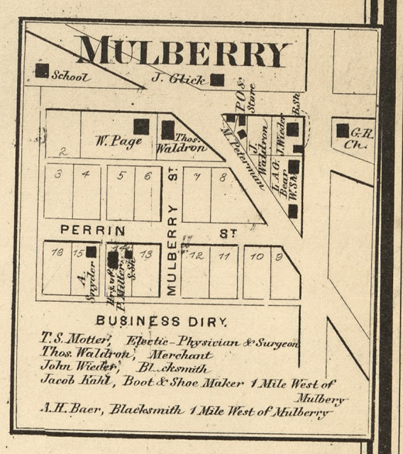
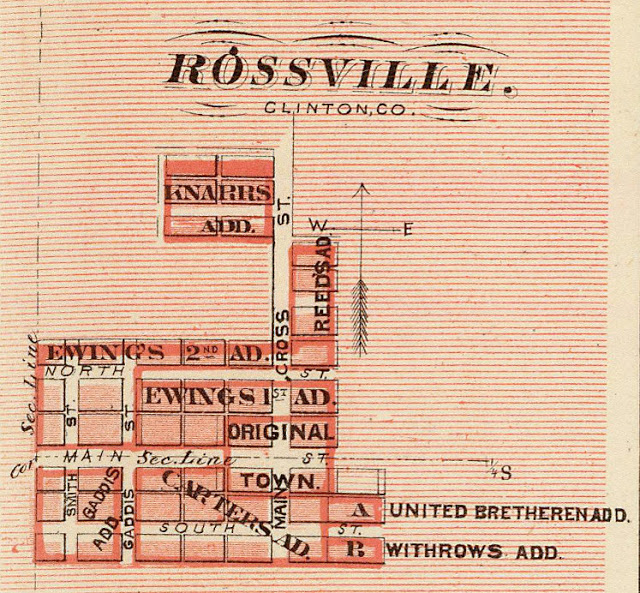
One large map with inserts showing detailed layouts of many towns, including Frankfort, Rossville, Mulberry, Hamilton, Penceville (later to become Kilmore), and many others. Also gives population size, business directory, and illustrations of courthouses.
1876 – Indiana Historical Atlas of The State of Indiana
This is not specific to Clinton County, but it obviously includes Clinton County, and even has some detailed plat maps of Rossville, Cofax, Frankfort, etc. Also wonderful illustrations of Lafayette, Carroll County, etc., in the same style as the 1878 Atlas. Also available at the David Rumsey collection.
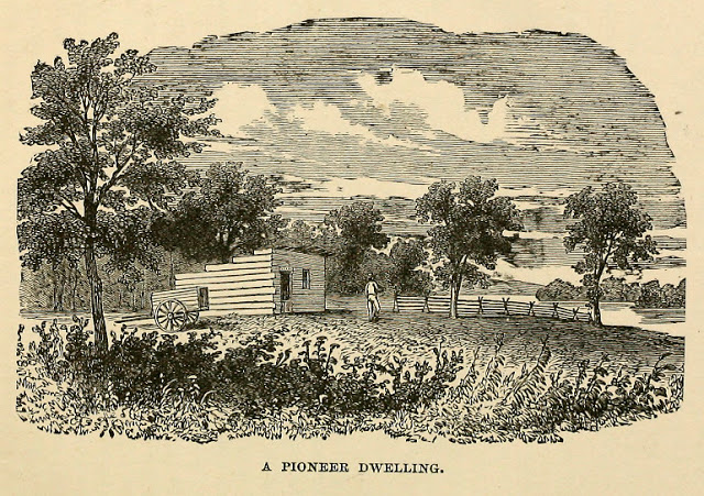
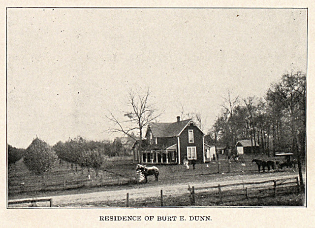
1878 – Combination atlas map of Clinton county
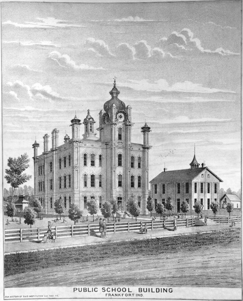
This is a great one full of many wonderful illustrations of homes, farms, and people. We have digitized it so you can access in full here and look at the illustrations which we have extracted, retouched, and mapped here.
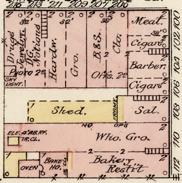
1887-1898 – Sanborn Fire Insurance Maps
These fire insurance maps not only give an accurate layout of the town, but extreme details on particular buildings, including their dimensions, material, and what each room is used for. It even shows locations of stoves, etc. They are a truly incredible resource and really give you the feeling of what towns were like back then. Maps are available online for Frankfort, Colfax, and Kirklin. Maps for Rossville from 1926 exist but are not available digitally yet. They pass into the public domain in 2022 so expect them to become available then.
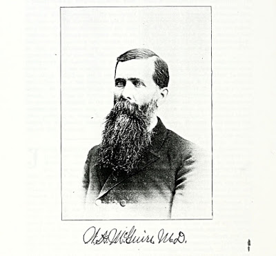
1903 – 20th century atlas of Clinton county
Full of photographic portraits with small bios and a wonderfully bizarre full-page ad for a Frankfort funeral home. Searchable via the this index or the master Clinton County Index.
1917 – Bowen’s Indiana State Atlas
This pairs very brief thumbnail histories of each county with a nicely detailed map depicting the location of many schools.
1919 – Atlas and plat book of Clinton County
This one has the distinction of originating not with a Chicago company but the Frankfort Morning Times. It includes a history of World War I and some interesting photographs and illustrations pertaining to the war, along with an honor roll of Clinton County’s soldiers in WWI. Most of its local information, however, is limited to the plat maps.
1920? (date uncertain) – Plat Book of Indiana Counties Vol 1
A simple plat book from the archives of IUPUI.
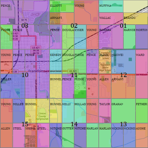
Modern Day (With Hints Toward The Past) – Clinton County Public Property Records
This is an incredible tool for looking at the parcel divisions, right of way data, etc., and discerning the original layouts of small rural towns.
Historical Societies
Carroll County Historical Society and Museum
This is a truly exceptional resource for anything pertaining to Carroll County, with some material pertaining to Clinton County as well. Their photo collection alone is well worth a membership, and I love that they have digitized so much and made it available. They also have all kinds of genealogical databases, indexes, etc., which can be searched through their website, though do note that you have to be a paying member for access.
Monon Railroad Historical Technical Society
Great information on anything pertaining to the Monon Railroad, including a large collection of images, only some of which are viewable online. Others can be purchased on disc. Their Bygone Places Along The Monon project is a truly wonderful contribution to small-town history. You’ll find photos and information about Clinton County on the Second Subdivision section, including Rossville, Cambria, Frankfort, Cyclone, and Kirklin.
Tippecanoe County Historical Association
Wide-ranging archives containing collections pertaining to just about anything you could think of in Lafayette and the surrounding areas.
Clinton County, Indiana Genealogical Society
A great, active group holding regular events at the Frankfort Community Public Library, which they post about on their Facebook page.
Boone County Historical Society
Our neighbors to the south. They are housed in the Cragun House, a beautiful late 19th century mansion. Their website says they “maintain a large number of old original records which may be accessed by appointment.”
Tipton County Historical Society
Based in the Heritage Center & Museum, they display artifacts and house thousands of historical documents, including the courthouse records from 1844 to the early 1950s.
Howard County Historical Society
Even though they took a bite out of our northeast corner, we still like Howard County. They are housed in the Seiberling Mansion/Howard County Historical Museum, and have an incredible online archive of tens of thousands of photos.
Hamilton County Historical Society
Our southeasterly neighbors reside in an old Sheriff’s residence and jail, where they have a collection of artifacts, photos, and documents.
Montgomery County Historical Society
Based in Lane Place, a former Senator’s home built in 1845, this society also has a museum and archival holdings, which are listed in detail on their website.
Indiana Historical Society
The big dog on the block. They offer a wide variety of materials and local history services.
Newspapers
Although there are new Clinton County papers digitized as yet, you can find a lot of information from within our county in papers from surrounding towns that have been. Here are some that have proven useful.
Carroll County Newspapers – Carroll County Libraries
A terrific collection stretching back into the 1830s. A lot of coverage touching on Clinton County in here.
Hoosier State Chronicles – Indiana State Library
Search papers from all over Indiana or by county, including Tippecanoe, Cass, Boone, etc.
Lafayette Journal and Courier Archives
Searchable archives going back to 1920. Behind a paywall, but you can make clippings that become available to the general public.
Miscellaneous
The Indiana Album
An organization devoted to digitizing old photos in Indiana with a great collection you can search online. They do charge for high resolution access and print rights, but their online images are free to share with attribution.
Interactive Indiana Geological Survey Map
An invaluable resource packed with data–everything from census population statistics to crop information. It is especially useful for figuring out what township and section a given town or property is in (though the Bureau of Land Management has a simpler interface for that).
Bureau of Land Management General Land Office Records
This is a searchable database of the patents from the original purchasers of land from the U.S. government. You can search by name, county, date, or section, and you can even see images of the retained clerical copies of the grants issued in the name of the President at the time. Many families have kept originals to the present day, and some have been donated to us. The earliest entry for Clinton County is 1826.
Early Indiana Trails and Surveys
A fascinating book on the early surveying of Indiana with great information for doing your own research.
Field Notes for Public Land Survey Township Plats 1789 – 1946
These are the notes written by the original surveyors of the area as the divided the land into townships and sections, mostly around 1820-1823 in our area. (See “Early Indiana Trail Surveys,” listed above, for help making sense of this stuff.) The index used to indicate what volumes contain can be confusing and misleading, especially since the website’s volume titles (such as “Indiana: Volume E-14 – E-16“) do not match the volume numbers actually in those files. (That one, for instance, actually starts with E-11 and ends with E-13.) If you don’t know the township identifier of the area you’re looking for (such as T 22N R 2W for the township containing Mulberry), use the Indiana Map from the Indiana Geological Survey, make sure the PLSS Townships and PLSS Sections layers are active, and get it from there.
INGenWeb – Genealogy Websites
In the Clinton County and other sections, you can find all kinds of pictures, book references, transcriptions, etc.
Historic House Research Guide – IndianaLandmarks.org
Pretty much what the title describes.
MapWarper.net
A great tool for warping and geocoding historical maps to overlay them on current satellite imagery in Google Earth, pinpoint exact locations of historic sites, etc.